Period: From February 2026 Issued on 05.02.2026 using data to the end of January 2026
Rainfall:
January’s rainfall was above average for the UK (117%), but with strong regional contrasts. Eastern Scotland, Northern Ireland and parts of central and southern England recorded over 170% of their average January rainfall. Much of this rainfall occurred towards the end of the month from storms ‘Ingrid’ and ‘Chandra’. In contrast, northwestern areas received below normal rainfall, with northern Scotland receiving less than two-thirds of average. The forecast (issued by the Met Office on 26.01.26) indicates the chance of widespread wet conditions in February is slightly less likely than normal, but wetter conditions over southern UK are possible. Over the next three months, the forecast indicates rainfall in the normal range is likely with chances of a wet and windy February-April close to normal.
River flows:
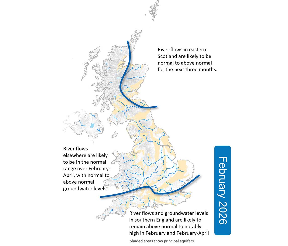
January river flows were normal to below normal in northwestern areas but widely above normal elsewhere, with notably to exceptionally high flows in eastern Scotland, Northern Ireland and parts of southern England. River flows in groundwater-dominated areas of East Anglia remain in the normal range. Following a wet start to February for eastern Scotland and parts of southern England, the outlook is for above normal to notably high flows in these regions to persist over February. River flows elsewhere are likely to be in the normal range, except for western Scotland where normal to below normal flows are possible. The outlook for the next three months (February-April) is for normal flows to dominate across the UK, except for eastern Scotland and southern England where above normal flows are likely to persist. With wetter conditions less likely in northern areas, there is also an elevated chance of below normal flows persisting for western Scotland.
Groundwater:
Groundwater levels were mostly normal to above normal at the end of January. Notably to exceptionally high levels were registered in Northern Ireland and southern England whilst normal to below normal levels were seen in eastern Scotland and the chalk of East Anglia. The February outlook is for levels in southern England to remain notably to exceptionally high. Across the rest of the UK, levels are likely to be in the normal range, with continued below normal levels in parts of East Anglia. Over the next three months, groundwater levels are likely to stay above normal to notably high in southern England and normal to above normal elsewhere.

