NOTE: The URL for the Portal has recently changed and as such users should update their bookmarks: https://ukho.ceh.ac.uk/.
The UKCEH Hydrological Outlooks Portal provides interactive, dynamic access to many of the outputs of the UK Hydrological Outlook.
The Portal allows users to visualise the model outputs from the Outlook, both spatially and in the form of a number of time series. This allows users to explore the hydrological forecasts for the next one to three months, and sometimes beyond.
These outputs provide information on the likely trajectories of river flows a season or more ahead, and their production is intended to help support water resources managers in their decision-making. Importantly, however, as with all forecasts, these outputs are based on model projections with many uncertainties, so should be used with caution. Users should be aware of the methodologies used to make the forecasts, and their attendant uncertainties, as described on these pages and in further references.
There are three different forecasting approaches used for river flow forecasting in the Hydrological Outlook:
Historic Based Forecast Methods
- Persistence and hydrological analogues
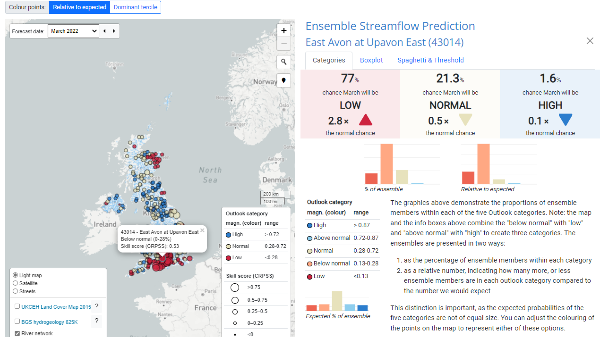
- Ensemble Streamflow Prediction (ESP) method
Meteorological Based Forecast Methods
- GR6J
- Water Balance Model (G2G-WBM)
Current Conditions
In addition, this portal information on current conditions from a 1km gridded Grid-to-Grid (G2G) hydrological model run alongside relative wetness/dryness maps, storage anomaly and deficit recovery information.
There are several products presented as part of these current conditions.
- The mean flow product shows the mean river flow for every pixel (or averaged over regions) over the preceding month.
- The subsurface wetness and soil wetness products indicate the relative wetness of subsurface water stores (soil and groundwater) and soil water stores relative to their historic extremes.
- The storage anomaly product indicates the deficit (or excess) subsurface storage depth relative to the historical monthly mean.
- The deficit recovery maps show the return period of accumulated rainfall required to overcome any regional subsurface water storage deficits over the next few months.
At present, only the river flow forecasts from the Hydrological Outlook are available on this Portal. We are planning to release groundwater forecasts in the near-future, in collaboration with the British Geological Survey.